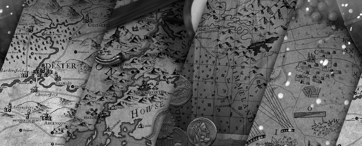
Historic(al) Map Porn
If anyone would like to help me set up these communities and/or mod, please get in touch. This place is what we make it and I’d love some fresh ideas. I mod a number of smaller science subreddits and would like to help make this place just as nice, if not better!


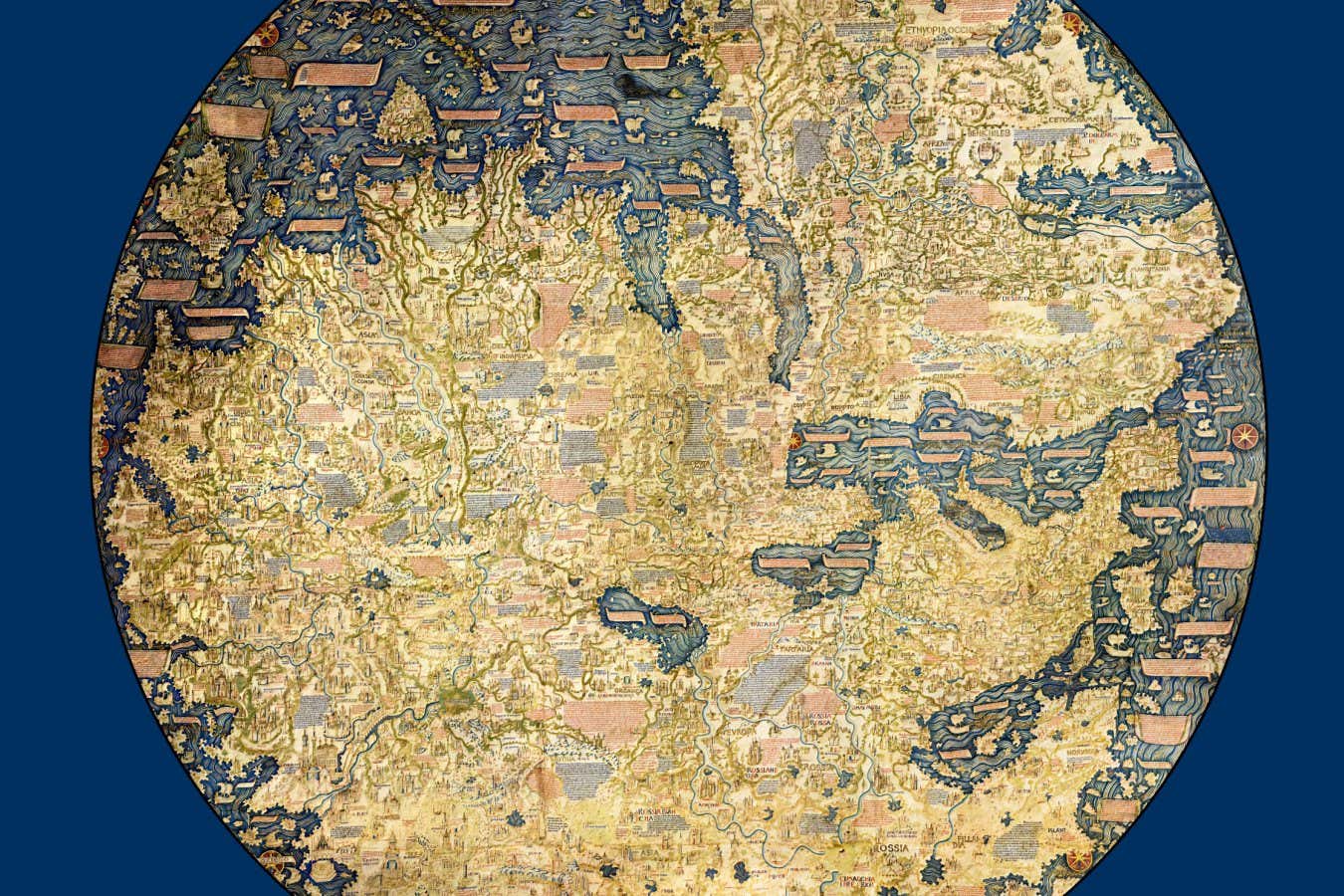
 oculi-mundi.com
Oculi Mundi is a digital heritage destination: the home of The Sunderland Collection of world maps, celestial maps, atlases, globes and books of knowledge. The Collection was built out of a personal passion for travel, history, and the imagination. We seek to make it as accessible as possible — for study or for pure joy. Oculi Mundi takes a fresh, innovative approach to presenting antique material online. We have tried to exploit the full potential of the digital environment and the best of current technology. As tech evolves, so will we!

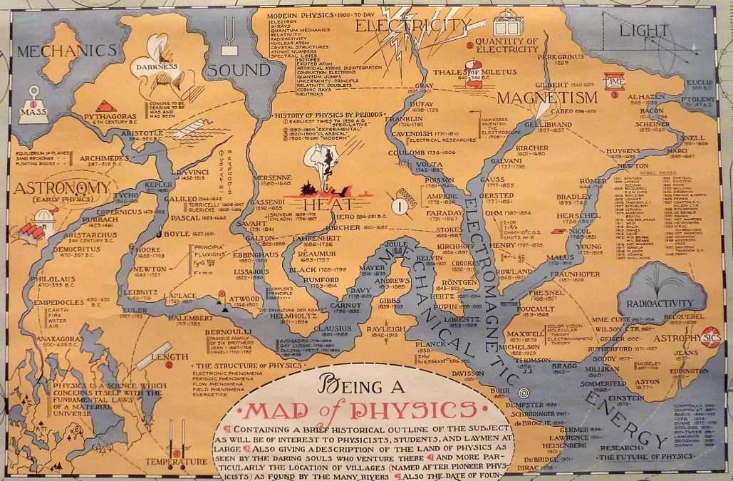
Sauce: https://mastodon.social/@gutenberg_org/111845638304911489


https://www.hmdb.org/

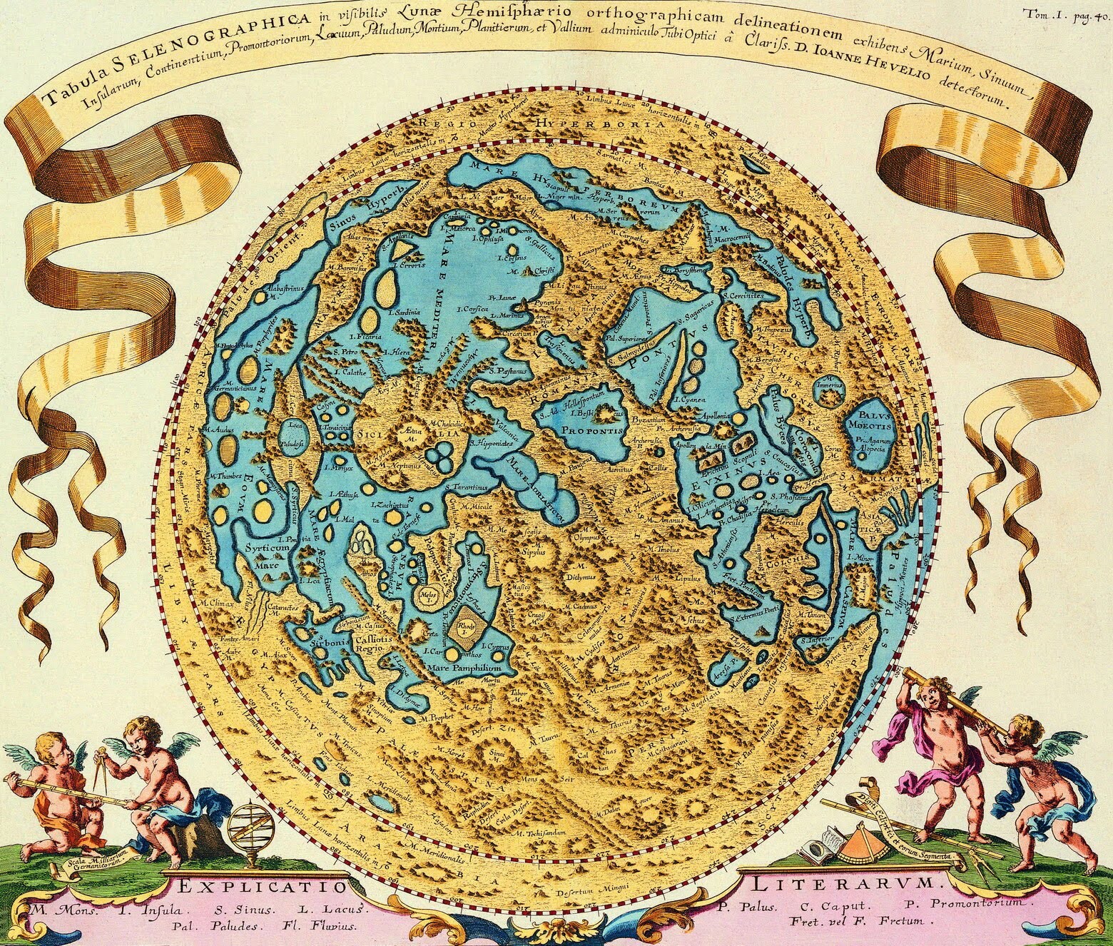
Sauce: https://c.im/@dangerousmeredith/110680821303834096


The map is known by the name of its author, admiral Piri Reis. Only half of the original map survives today. Source: [Wikipedia](https://wikiless.funami.tech/wiki/Piri_Reis_map?lang=en)

I find it interesting that the maker chose to orient the map east upwards. [Image description: an old map of the coast of southern and western Norway, decorated at the top with scenes of fisherman and pastoral life]

Sauce: https://botsin.space/@artefactCollection/110652476838849272

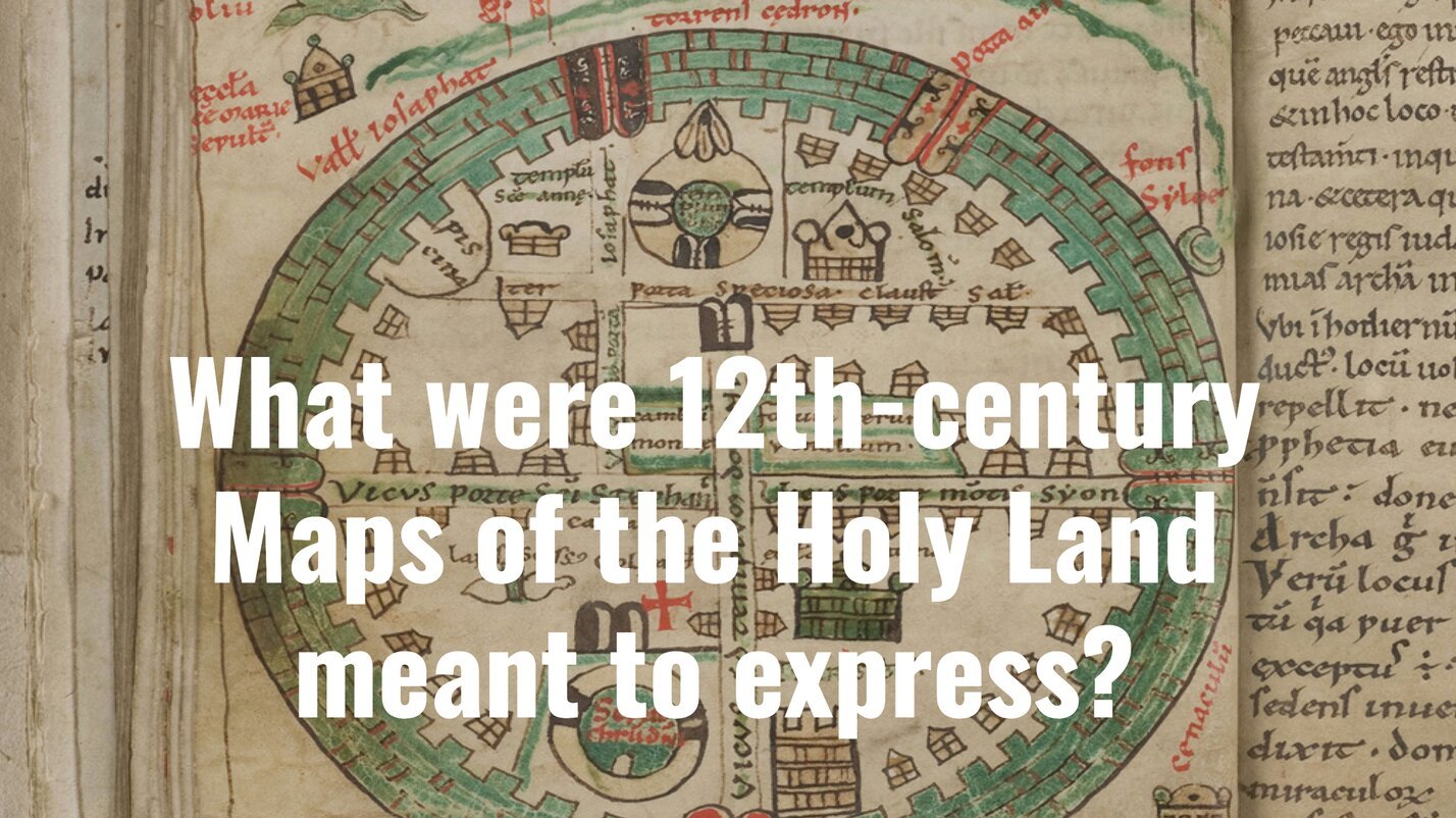 www.medievalists.net
Maps of the Holy Land were first produced in the Latin West only at the beginning of the twelfth century. It is generally accepted that the establishment of the Latin Kingdom of Jerusalem (in 1099) led to the creation of these maps and that the purpose was to represent Jerusalem and the biblical land in its renewed Christian appearance, with an emphasis on the Crusader achievement.

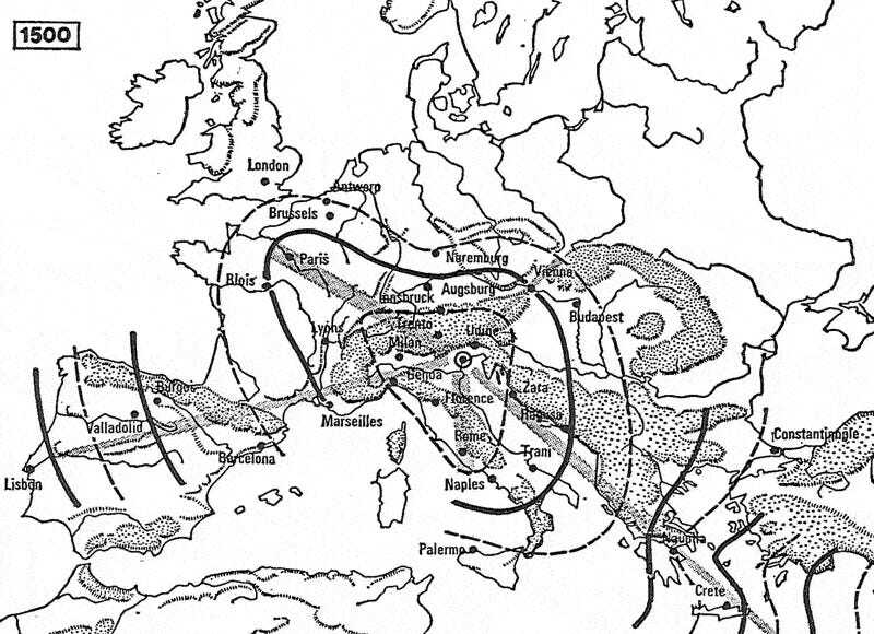
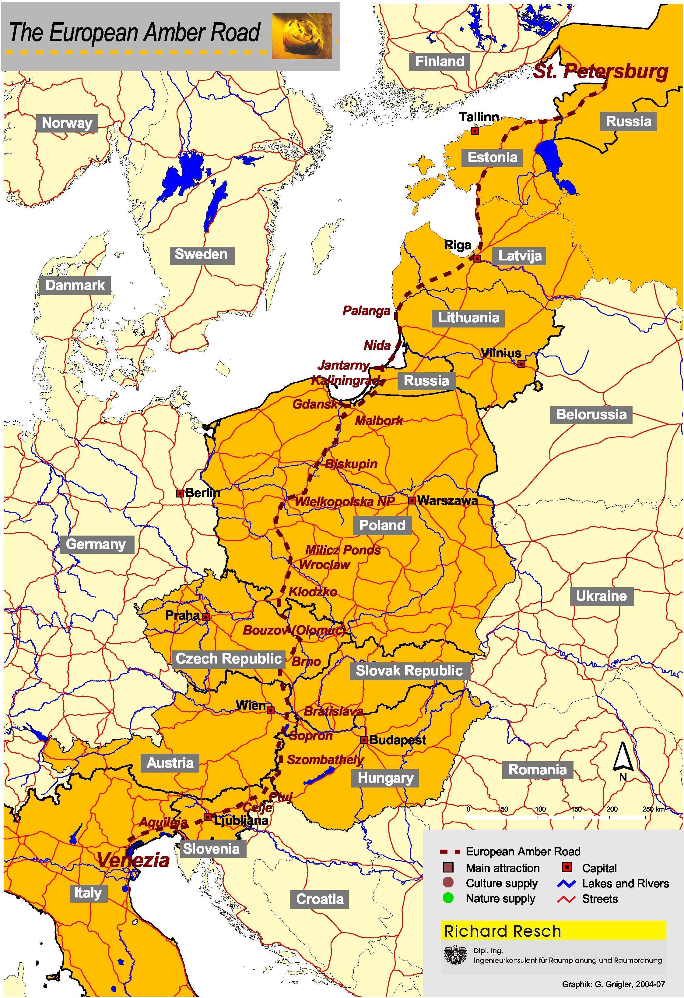
This will likely be rather rudimentary for experts and professionals, and the map itself isn't pre-1950 but I recently visited northern Italy and had my interest piqued by Aquileia; which lead me to begin looking for info on trade routes from which Baltic amber was able to reach ancient Egypt, Greece, Rome and The Caucasus. I was aware that Cornish and Breton tin had been used in the Late Bronze Age in the Mediterranean but hadn't really considered the trading of Amber which for which the routes pre-date those for tin. I find the idea of these ancient trade routes to be wonderfully thought provoking. Romanticising about how cultures like the Únêtice organised themselves and cooperated in order to facilitate trade. If anyone here has spent any time reading about this trade route I would be grateful to hear of anything you found of interest regarding the settlements, societies, professions and daily lives of the peoples involved in this trade.


Historic(al) Map Porn
!old_maps@mander.xyzWelcome to c/old_maps @ Mander.xyz!
A community about captivating historic and historical maps from around the world, from the oldest examples known to those created around 1950.
Notice Board
This is a work in progress, please don't mind the mess.
- 2023-06-13: We are looking for mods. Send a dm to @fossilesque@mander.xyz if interested!
About
Rules
- Don't throw mud. Be kind and remember the human.
- Keep it rooted (on topic).
- No spam.
Links
Similar Communities
Sister Communities
Science and Research
Biology and Life Sciences
- !anthropology@mander.xyz
- !microbiology@mander.xyz
- !biodiversity@mander.xyz
- !palaeoecology@mander.xyz
- !palaeontology@mander.xyz
Plants & Gardening
Physical Sciences
Humanities and Social Sciences
- !archaeology@mander.xyz
- !cooking@mander.xyz
- !folklore@mander.xyz
- !history@mander.xyz
- !old_maps@mander.xyz